
Let’s go hiking!
Hiking, an activity that popular the world over. Especially here in China.
Shenzhen has several hiking options and it can be difficult to know which ones to do. This is a quick guide to a few of them. There are others and they will be listed later. As with all hikes, there are many routes, start points, end points etc. These can’t all be covered, so only the main routes will be listed here.
Wutong Mountain. Difficulty 5/5
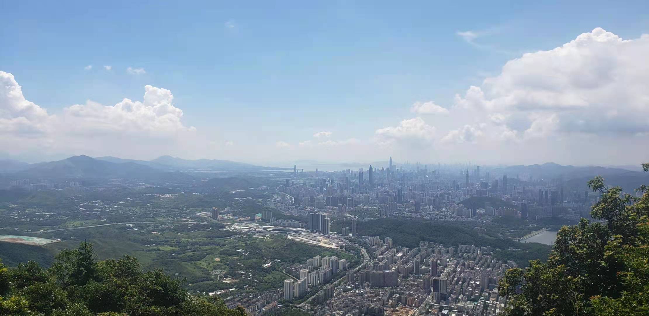
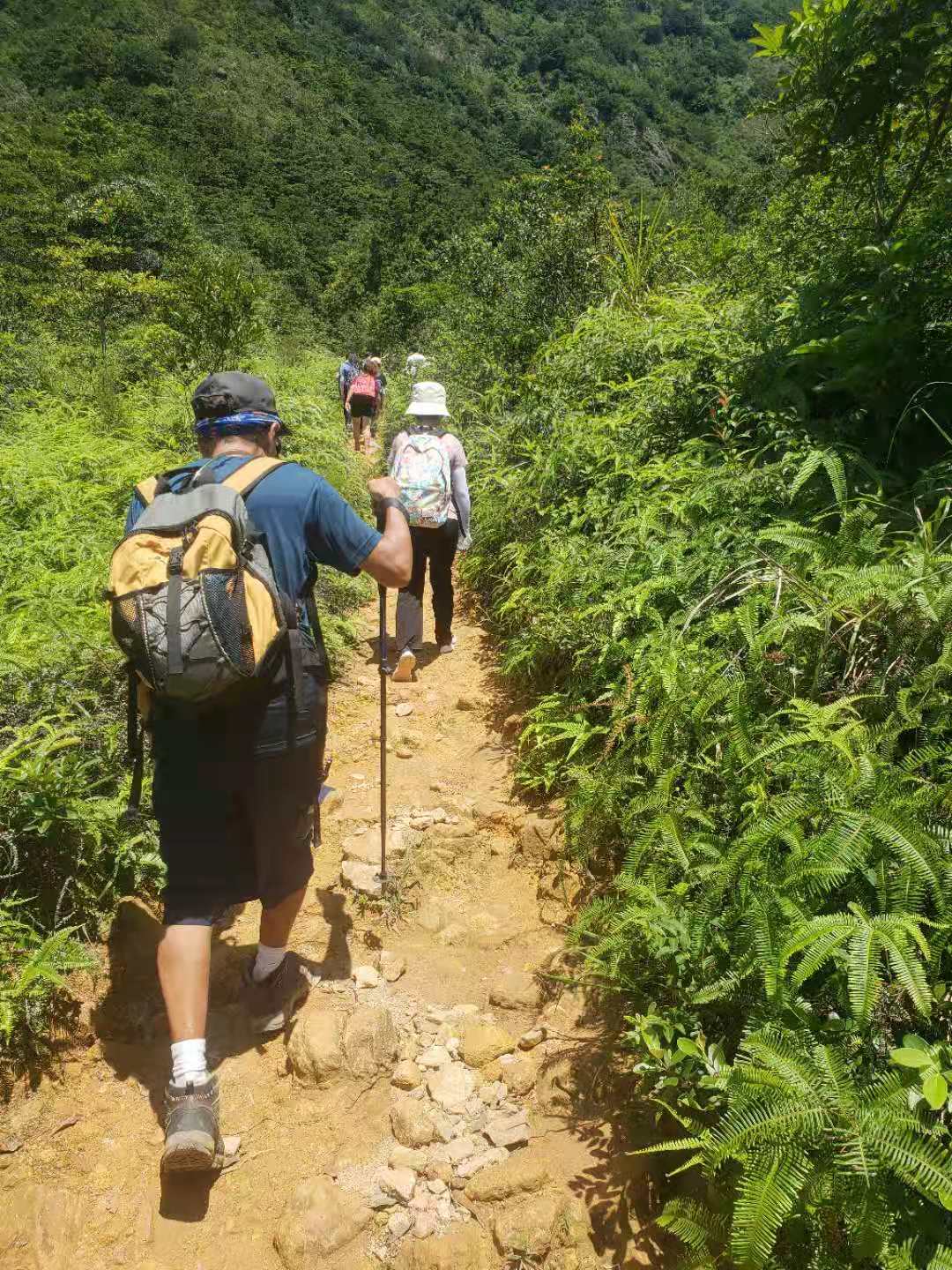
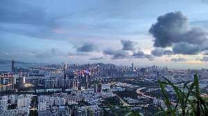
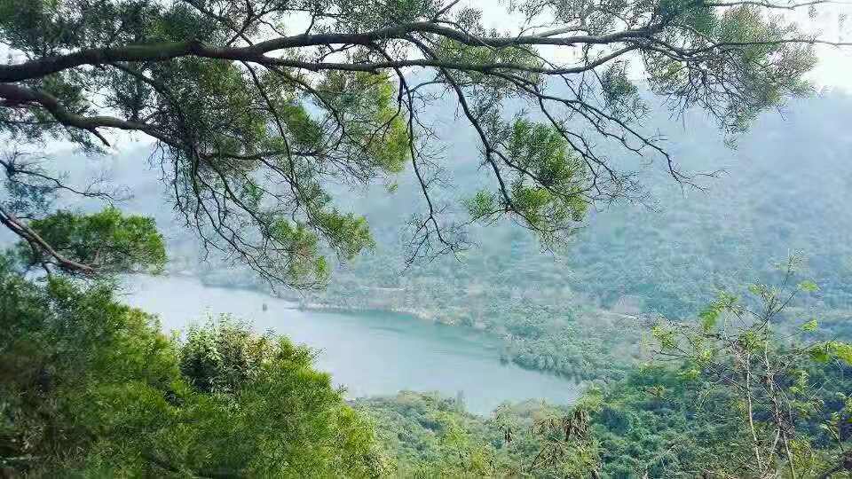
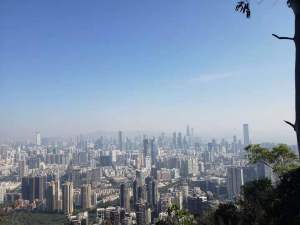
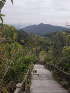
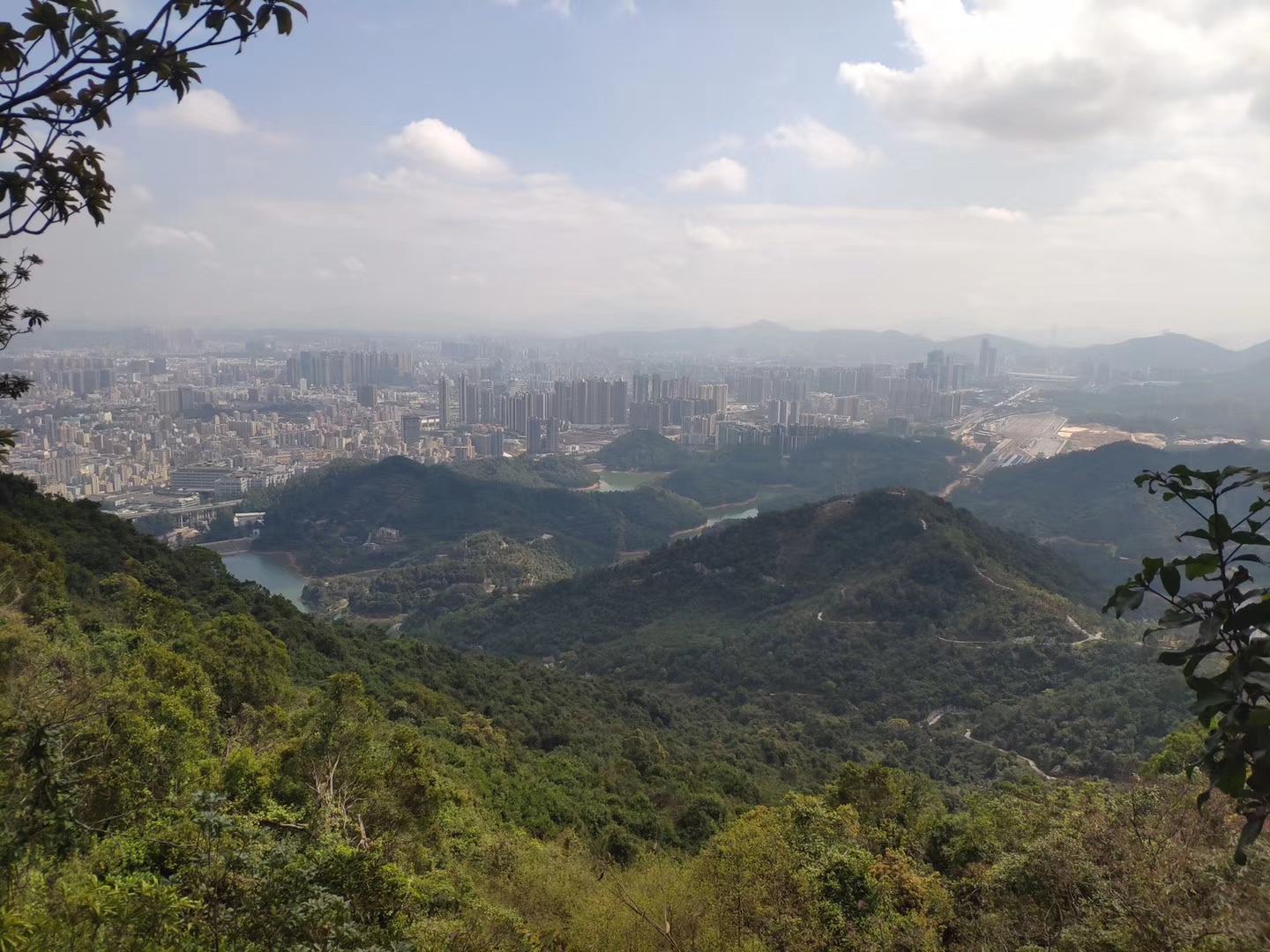
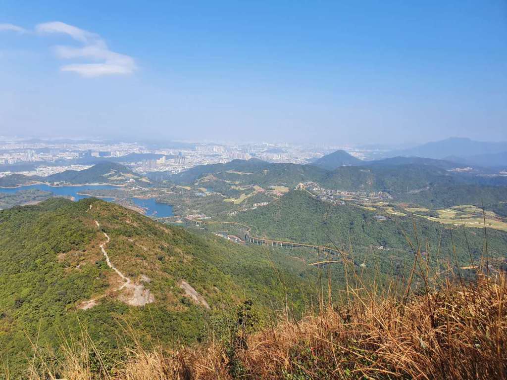
Start with the biggest most well-known. The highest mountain in SZ this stands an impressive 940M high. It’s also the most challenging of the peaks in the city. But for those who conquer the climb you’ll be rewarded with magnificent panoramic views of the city, it’s a breathtaking sight! Densely vegetated, it is popular and offers a stunning vista of the coastline and Shenzhen Reservoir year-round. Sadly as with most hikes in China there are a lot of stairs so prepare yourself, although there are 2 paths you can take from the main gate so each visit could be slightly different for you. 1 is a flat path and one has stairs so it’s up to you which one you take. As you hike you will pass numerous streams and creeks along the way. This is the winner for views, and the winner for difficulty if you’re looking for a challenge.
WUTONG MOUNTAIN IN DETAIL HERE
Small Wutong also has the iconic TV tower and if you combine small and big Wutong it will be an excellent hike.
Directions
- Chinese Name: 梧桐山
- Place Address: Wutong Mountain village, Luohu District, Shenzhen
- 深圳羅湖區梧桐山村
- Phone: 0755-25152005
Or you can take metro to line 8 ‘Wutong South Mountain’ and walk 10 mins from exit D. It you take the nature trail for small wutong, keep walking on the greenway road for around 30 minutes, you’ll see a dirt path eventually on your left
For Big Wutong you can get bus 211 from Cuizhou metro station exit B or bus 445 from Huanbeiling

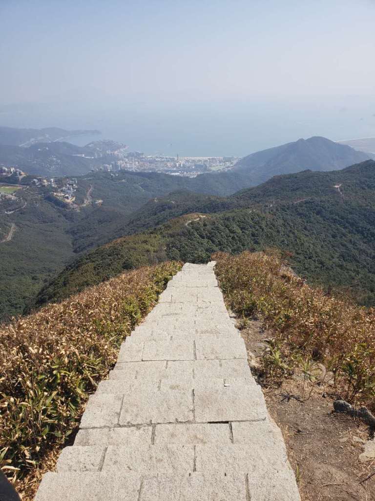
Qiniang Mountain. Difficult 4/5 (stairs)

Second highest in SZ it is slightly lower than its Wutong cousin at around 800m. Located in Dapeng area this is a nightmare to get to because of weekend traffic, taking 90 minutes from city centre. This is mainly stairs, and would be difficult for beggingers but not so bad for those who hike often. There are great views on offer of the ocean and of the sweeping panorama below you. There is a nice grassy area on the top which is good for lunch or to fly a drone.

Directions
I suggest to get a taxi to this location as the entrance is right here
Chinese and Pinyin Name: 大鹏半岛国家地质公园
There is no subway currently here and buses will take a long time so just get a shared taxi.
Maluan Mountain. Difficulty 3/5
Please read the detailed guide to this hike here Maluan Mountain – the best hike in Shenzhen?
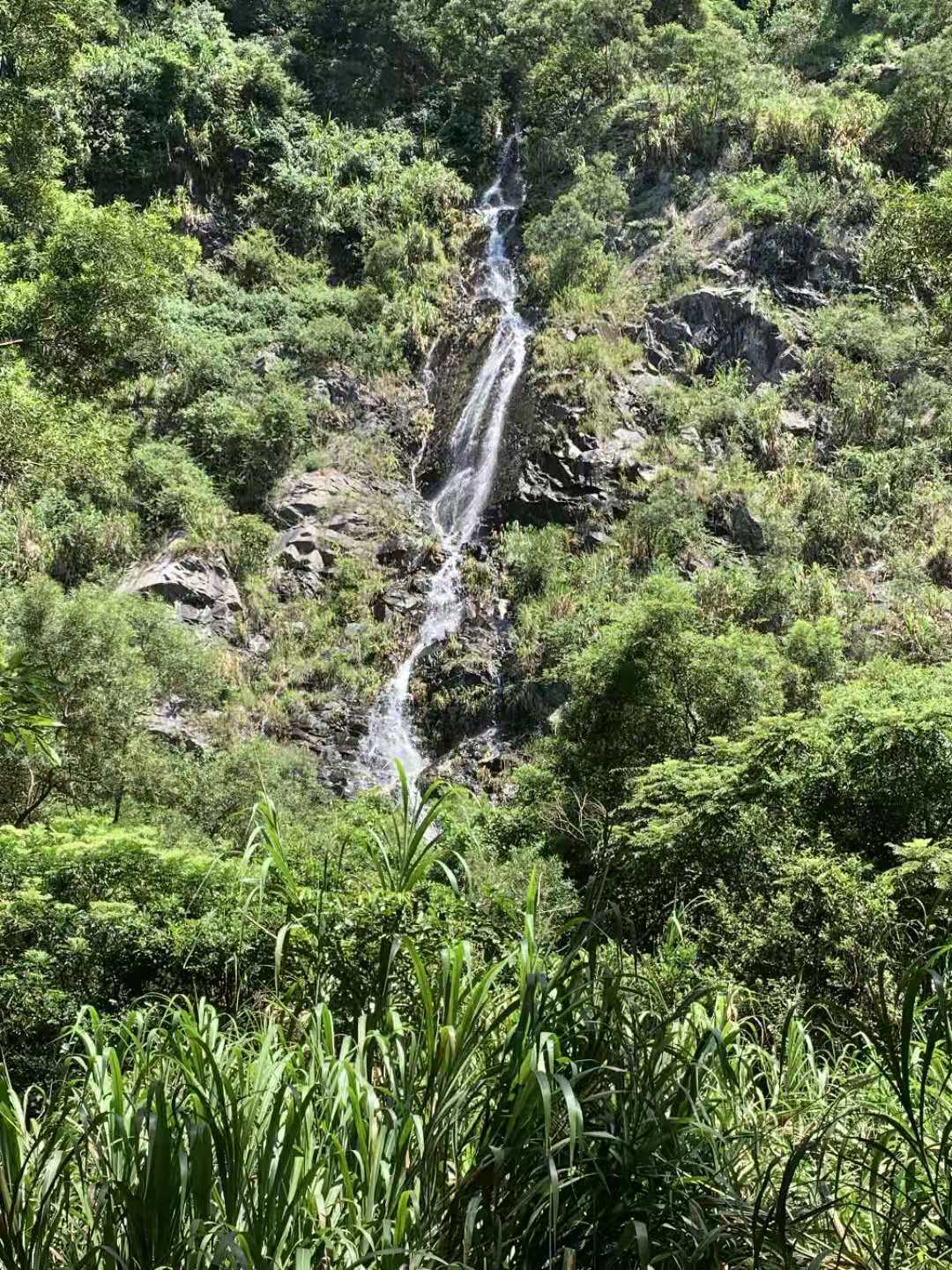
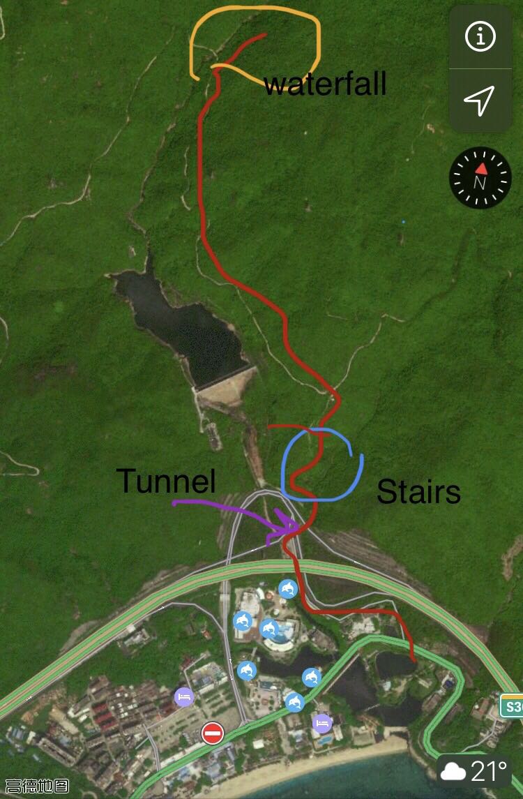
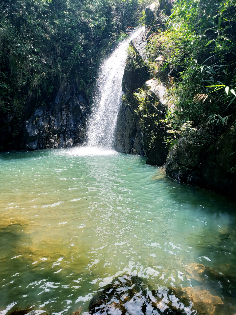
Maluan Mountain is one of Shenzhen’s best kept secrets. However, it is extremely popular among avid hikers because it’s easy, safe, beautiful and varied with clear streams, lush woods, Chinese plum blossoms and one of the area’s largest waterfalls. Maluan Mountain is 300-590 meters above sea level. In the hot summer, its temperature is lower than the city by 3 degrees Celsius. Without the industrial pollution and noises from the city, Maluan Mountain has kept its pure, refreshing environment. It’s also worth going every December and January when the orange trees harvest and all you can see are the fruits hanging from the trees. You can always pick some fruits, too! At Maluan Mountain, you can have a good view of the ocean, the lake and the waterfall. It’s also the home of many different plants and animals, some of which are endangered species. It’s a good place for a relaxing family outing and a wonderful getaway from the city. When you do get to the top you can eat and drink beer with the locals as there is a delicious restaurant nearby. Location is also a bit out of the way. The hike starts just behind Xiaomeisha Ocean World. Additionally there is another entrance to this mountain that takes you past waterfalls and through the trees. But lots of stairs so be warned.
Directions
By public transport you can get bus M181, 103, 103B 380A directly to Xiaomeisha terminus and start the hike from there.
What I recommend if a small group I go to XinXiu metro station and get a didi to 小梅沙海洋世界 Xiaomeisha Sea World
You can now get the metro to Yantian on line 8. Get metro to last stop on line 8 then get a taxi.
Address: Xiaomeisha Scenic Area, Yantian District (深圳市盐田区小梅沙海滨旅游区小梅沙海洋世界)
Bring enough water as there isn’t anywhere to buy it on the trail


Tanglang Mountain Difficulty 3/5

TANGLANG GUIDE HERE
One of the most popular mountains in the city, located at the heart of Futian this is a nice casual trail usually busy with locals getting their exercise in. Tanglang Mountain has two routes for visitors to reach the summit: the winding road and mountain trail. Which one to take depends on your fancy. Both routes offer stunning scenery to make your trek leisurely. Both routes are popular so expect a lot of people. It provides some nice views of the city but at just over 300M high don’t expect panoramic landscapes in front of you. At the top you’ll find a viewing point and a nice large rest area, with people relaxing and eating snacks. Keep an eye out for the Tanglang monkeys that might make and appearance. This is also the best night hike in the city, as it has great views and convenient location. I usually hike it at night once a week

Directions
Taoyuancun metro station exit C (line 7) turn right at the traffic lights and keep walking forward.
Can also start at Meilin reservoir from Xiameilin metro station exit D (line9) then turn up the stairs when you see the Tanglang sign. Many many stairs here
塘朗山 Tanglang Mountain
Longzhu road North, Nanshan North East side, Shenzhen
深圳塘朗山郊野公园位于深圳市南山区东北部,龙珠大道以北,留仙大道以南,西起红花岭,东止于福田区与南山区交界
Taoyuancun metro (line 7) exit D
ALL THE PARKS IN SHENZHEN
Nanshan Mountain difficulty 3/5
GUIDE TO HIKING NANSHAN MOUNTAIN HERE
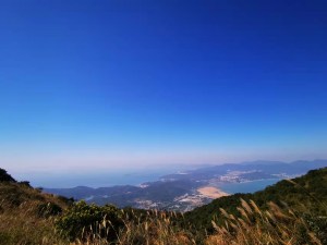
The easiest hike in the city in my opinion. This is a hike you can do one morning or evening and fit it around your schedule. Taking 1-2 hours max it falls into the casual category. From early morning till late at night, you will never be alone when you are on this mountain. Nanshan mountain is only about four hundred meters in height, so, if you are on the mountain, you will encounter people of all ages, such as the elderly, young parents carrying their new born babies, and even toddlers who are climbing the mountain using hands and feet. Taking the stairs is the best option here, as it is not so high and is do-able even by a casual hiker. The views of Shekou below are excellent and on a clear day can see far into the ocean. There are numerous rest stops along the way. It’s nice for a casual relaxing hike or for beginners, even a serious hiker can get a nice kick out of the great view on offer. This is also my recommendation for a night time hike too, as you can get some nice shots of the city all lit of, but the path isn’t so well lit so be careful. There are different end points to this mountain, you can start and end at seaworld, or continue on and finish nearby Shekou Walmart area.
Directions
Seaworld metro exit A
No.8 Shekou Villa, Nanshan District, Shenzhen China
南山
南山区南山村南巷(荔源大厦附近), 深圳市
舞茶道南山深圳大学店
You can also enter from nearby ‘Smelly Cat’ coffeeshop in Shuiwan. Head to KIS International School
请带我去韩国国际学校。(Pinyin: qingdai wo quhanguoguojixuexiao)
From Shekou Walmart, go west direction, there is an entrance; from City Garden, go a bit south then turn right at the 7 Days hotel, walk about 10 munites, there is another entrance.


Pheonix Mountain (fenghuangshan) 3/5
Fenghuang or Phoenix Mountain in the Bao’an District of Shenzhen is steep but striking. It is 678 meters high and overlooks Shenzhen Bay in the south. It is covered with large trees and colorful flowers. What makes this unique are not just the fountains and caves but the old temples that give it an air of serenity. Along the way up you can take the stairs or the ‘stream trail’ and you can get to the temple in around 30 mins or so. After the temple it takes around another 60-90 mins to get to the top top. Its not one of my favorite hikes but its ok.
GUIDE TO PHOENIX MOUNTAIN HERE
Directions
Tangwei Metro station line 11 or Qiaotou metro and get a short taxi to Pheonix Mountain park
Phoenix Avenue, Fuyong, Shenzhen 深圳福永镇凤凰山大道

Meilin mountain 3.5/5


For a more in depth guide please read these
Meilin Walk Shenzhen
Meilin Mountain Shenzhen– The city hike
More difficult than people think, Quite a popular trail with the locals because of easy access and medium difficulty. There are stairs but also has dirt paths along side so the choice is yours. Views are not to great but there is nice nature on the way. It’s a good hike morning or afternoon, but doesn’t seem lit so wouldn’t suggest going at night. Nowhere to buy water so bring your own. The reservoir provides a nice stroll and if you keep going on this path eventually you’ll see a sign to go up, this connects to Tanglang mountain too. I suggest reading the in depth guide below as there are many entrances and exits

COMPLETE MEILIN HIKE GUIDE HERE
Directions
Meilin mountain park entrance
Meilinshan Park, Meilin Rd, MeiLin, Futian District, Shenzhen 深圳市福田区梅亭路14号梅林山公园
Qiaoxiang metro exit C
Meilin Reservoir Start
Xiameilin metro station (line 9) exit C and walk straigh ahead towards the reservour. Can’t miss it
Tanglang Start
塘朗山 Tanglang Mountain
Longzhu road North, Nanshan North East side, Shenzhen
深圳塘朗山郊野公园位于深圳市南山区东北部,龙珠大道以北,留仙大道以南,西起红花岭,东止于福田区与南山区交界
Taoyuancun metro (line 7) exit D
IF YOU NEED TO GET A TAXI TO ANY OF THESE LOCATIONS. TRY DIDI TAXI ENGLISH. DOWNLOAD HERE

Yangtai mountain 3.5/5
This is a mixed mountain. If you take the main entrance then expect as with most hikes, people and stairs. When you do get to the top you can see some truly fantastic views of Nanshan and Bao’an and the reservoir below you. If you take a lesser known route, then you can get the views and avoid the people and the stairs. You hike a dirt trail through the woods, passing fruit trees, and wildlife along the way. It’s very quiet and very secluded. Word of warning, when you get to the top there are multiple ways back down that can lead to Longhua, Bao’an and Xili. So choose wisely. Nowhere on the way or at the top to buy food or water so bring your own. Try to spot the elephant rock, its quite a sight.#


DETAILED YANGTAI HIKE INFORMATION HERE
Directions
羊台山
Main gate take bus M115 from Longshen metro metro
Line 6 to Yangtai metro and follow the signs
Dirt trail Xili metro exit D, take bus 66 to the last stop. Then follow the road up through the village and into the trees
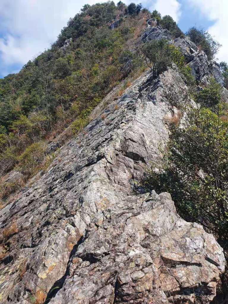
Dongxixhong hike difficulty 5/5
DETAILED GUIDE TO DONGXICHONG HERE
Dongxichong is a coastal hike between dongchong beach and xichong beach. It is around 6.5KM and takes around 5 hours. You can get absolutely breathtaking views of the coastline on this hike and it really really is worth it. There is a lot of up and down and rope/chain climbing. It can be very slippery. A lot of ‘boulder’ and rock scrambling is also required and balance can be difficult so go slow and steady.
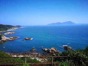

Good level of fitness is required for this, and some hiking experience. The views, and nature really are fantastic, but some negatives. On the weekend there is a enormous amount of people, and a human traffic jam. Very annoying and a little dangerous. Trash is also everywhere which is quite a shame.

There is no shade anywhere, so on a hit sunny day you will be exposed. Bring lots of sunscreen and water (you can buy along the way) and bring cash too.
Start at Dongchong village and enter the trail near the community center. End point is Xichong sightseeing beach.


Directions
Chinese Name: 东冲海滩
Address: Dongyong Tourist Area, Longgang District, Shenzhen 深圳市龙岗区东涌旅游区内
My advice is to get metro line 8 to Yantian then get a taxi to Dongchong village (approx 1 hour and 200-300rmb)
End point is Xichong beach and you can take a car from there to wherever (the guys will be there so negotiate) it is unlikely to book a didi here
Yuanshan mountain Longgang

Quite a difficult hike, this requires some fitness. At around 600M high you can get some good views on a clear day. It’s very unknown so it’ll be quiet. This is mostly stairs all the way up, however they are older stone style stairs surrounded by boulders and old trees. You can get some good cliff walkways and views and this place is a little different from the norm.

Directions
深圳市龙岗区横岗街道大康社区园山路101号

Yuanshan Scenic resort, Dakang Village, Henggang Town, 518115

Henggang Metro station line 3  then get short taxi (15 mins)
Mei Sha Jian difficulty 4/5
mei sha jian is a gorgeous scenic hike with sweeping ocean views located deep in the Yantian area. It is quite difficult with lots of steep stairs that seem to keep going up and up. You can get awesome views of the ocean and of the beaches below as well as close views of OCT EAST. The scenery is gorgeous and the photo opportunities are great. The stairs are a killer but well worth it


Directions
Little tricky to get to this one. Get the line 8 metro to Yantian Road station then you can get a taxi to the above location
Yinhu Greenway difficulty 4/5

This is a long walk, taking around 5 hours to complete and it is not recommended for beginners because of the lack of exit points around. You have different choices here, with flat paved road, stairs and forest path all available to you. You can do one of them or combine all 3. There are lots of signs around and you can interchange between them all at different points along the way. There is no place to buy water so bring enough. The start and end are near metro stations.
GUIDE TO YINHU HERE


Directions
Hanling metro station ( see above link for pics)
Beihuan Avenue No.1030 Sanjiu Garden, Luohu, Shenzhen 三九花园(罗湖区北环大道1030号)
Paiya Mountain difficulty 5/5
Guide to Paiya Mountain here
One of the most difficult hikes in Shenzhen, this is really not recommended for a beginner. It involes some steep rock face climbing as well as a lot of up and down. The total time is 7 hours for a good speed hiker. The problem with this hike is there are so many un signposted routes and you NEED to be with someone who has been here before. There are several clearly marked trails but they don’t all connect to the same place. No option to buy water along the trail. There also might be guards blocking the entrances, you will need to go around them


Directions
Little tricky to describe. Better to go by car as unlikely to find a didi to return. You can contact me for more information

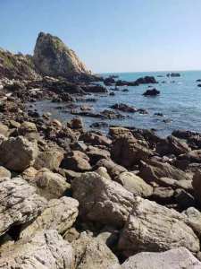
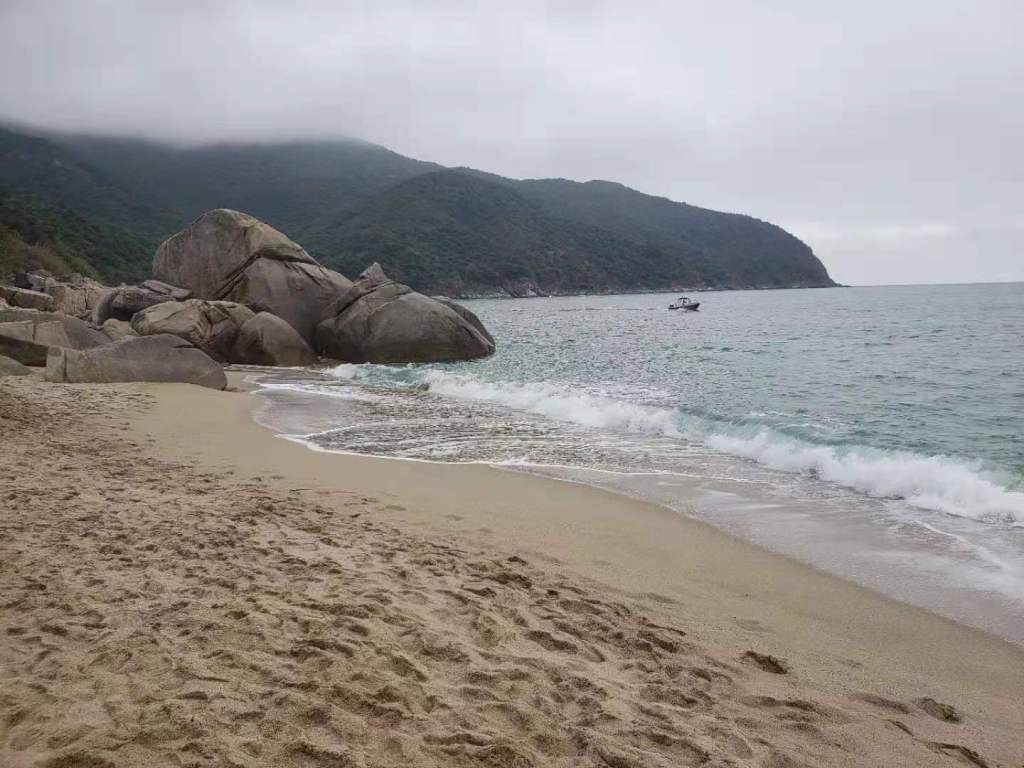
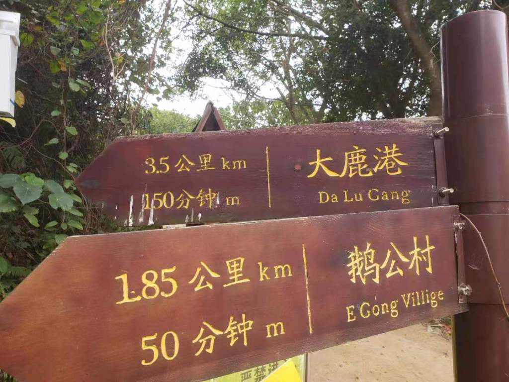
Dalugang Coastal Hike difficulty 4/5
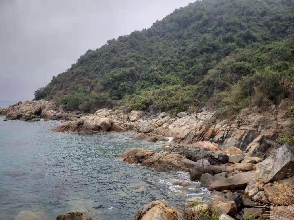
Dalugang is a coastal hike similar to Dongxichong. The difference is this one is quieter with less people and the rocks are larger rather than smaller. It is of similar difficulty. It goes for around 6KM and it ends at several points with Xigong village being the common one. There are at least 2 beaches here which are small but nice enough. Some people have fallen and died on this hike so you need to be careful.


Questions
If you have any questions about these hikes or want to join some of my hikes you can connect with me at anytime Connect with me


Leave a comment